One regional sea-level rise prediction has Napa River water in 40 to 60 years lapping into Kennedy Park, swallowing wetlands and flooding the rural, south county Milton Road community.
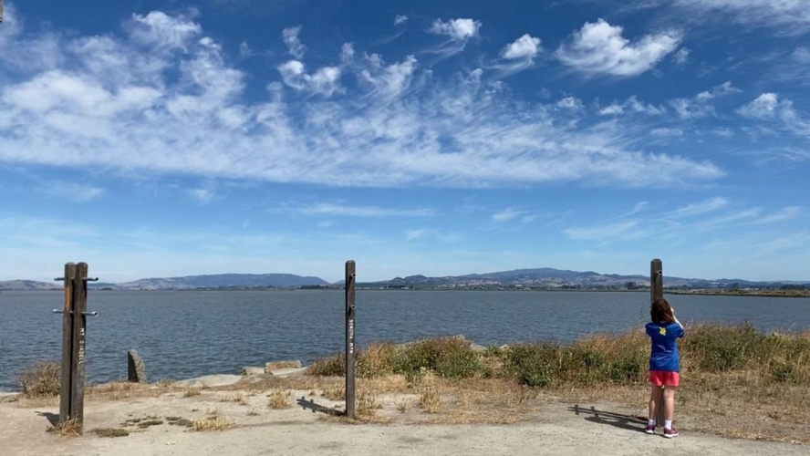
The wetlands in American Canyon is on the front lines of sea level rise, according to Bay Adapt research. City of American Canyon
Napa County looks at sea level rise predictions
Mar 13, 2022 at 3:35pm
That could be the result of a four-foot sea level rise if protective measures aren't taken, according to Adapt to Rising Tides. The consortium was created by the San Francisco Bay Conservation and Development Commission, National Oceanic and Atmospheric Administration and other agencies.
This work has resulted in the Bay Adapt Joint Platform, a regional strategy for dealing with sea-level rise. Possible steps mentioned range from restoring wetlands as buffers to avoiding development in flood-prone areas to removing some existing developments.
“It’s kind of a Bay Area-wide sea level rise call to action,” Napa County Planning, Building and Environmental Services Director David Morrison said.
On Tuesday, the county Board of Supervisors endorsed the Bay Adapt Joint Platform. But the discussion at that meeting and at a Jan. 10 county Legislative Subcommittee meeting showed county officials being cautious about this work in progress.
On one hand, the county could benefit from future Bay Adapt programs, Morrison said.
“At the same time, this is a fairly open-ended strategy, and it’s not clear where some of these paths may lead,” he said.
Adapt to Rising Tides research looks at several sea-level rise possibilities. A four-foot rise by 2060 is considered one of the direr scenarios.
Perhaps the biggest predicted Napa County effect is the Carneros-area Milton Road community going under four to seven feet of water. The 135 or so homes are separated from the Napa River by berms and levees built decades ago and maintained in patchwork fashion.
Morrison said Milton Road is the county’s biggest sea-level rise priority.
It's unclear how much Bay Adapt might help the county in such instances. Perhaps the Bay Adapt approach for flood-prone areas will be relocating residents. Morrison said Milton Road residents might have other ideas.
A 2018 study by local agencies looked at ways to protect Milton Road from flooding through such possible steps as building a flood wall and elevating houses.
A four-foot sea level rise could flood American Canyon’s wetlands trails, though the homes along Wetlands Edge Road should remain dry. Napa Valley College sports fields, Kennedy Park picnic areas and parts of Napa Golf Course would go underwater.
The Napa Pipe site targeted for more than 900 homes, a hotel, parks, trails and a Costco would be under 3.5-feet of water, according to the Adapt to Rising Tides prediction. Morrison said the Napa Pipe project includes flood protection improvements.
But how likely is a 4-foot sea-level rise in the Bay Area by 2060? A Bay Conservation and Development Commission report provides some context.
The Bay Area could experience a half-foot to a foot of sea-level rise by 2030, a foot to three feet by 2050 and three feet to 10 feet by the century’s end. The base year is 2000. A wild card is the rate of greenhouse gas emissions, the report said.
Supervisor Brad Wagenknecht referred to the flood control work Napa County has already done.
County voters in 1998 passed a 20-year, half-cent sales tax for flood control. That provided money to create flood terraces along the river and the flood control bypass between downtown Napa and the Oxbow area, among other things.
The Bay Adapt research goes through various scenarios, all the way up to a worst-case scenario of a nine-foot sea level rise. Then some city of Napa downtown neighborhoods and American Canyon neighborhoods could see a couple of feet of flooding.
Even then, Napa County fares better than most other Bay Area counties. In neighboring Solano County, this worst-case scenario puts downtown Suisun City under as much as eight feet of water. San Francisco International Airport and Oakland International Airport would be underwater.
Go to https://explorer.adaptingtorisingtides.org/explorer to see the various sea-level rise scenarios.
A Bay Adapt report acknowledges that sea-level rise “seems like a sleeper issue.” People can’t see it happening and are worried about the more immediate threats of drought and wildfires, it said.
But the bay, fed by a swelling Pacific and melting glaciers and ice sheets, is growing. Scientists project the slow, steady rise will speed up around 2040, the report said.
“By then, in the time it will take a current preschooler to graduate from college, it will be too late to start to prepare for the water that will be rising onto our airport runways and into our shoreline streets,” it said.
A 4-foot rise by 2060 would in the Bay Area affect 28,000 socially vulnerable residents, 1,900 residents living near contaminated sites, 13,000 existing housing units, 104,000 existing jobs and 20,000 acres of wetlands, lagoons and tidal marsh, according to Bay Adapt.
Other Bay Area counties that have endorsed the Bay Adapt platform are Contra Costa, Marin, San Mateo, Santa Clara, Solano and Sonoma counties.
See the full article from the Napa Valley Register here.